Hwy 10, West of Mandan

Hwy 10, West of Mandan

Sunday, July 1, 2018

The Commute

As most riding nowadays involves biking to and from work, I thought it might be interesting to document my commute through pictures and brief narration.  It's an easy, stress-free ride, largely absent of interactions with automobiles thanks in large part to the availability of multi-use trails in Bismarck and Mandan (which make up more than half the route).  Commute time ranges from 40 to 55 minutes, depending on the direction and velocity of wind.


Here's the ride, with photos taken during a pleasant morning on Father's Day weekend:


(Emerging from the side door of the garage...)

(...and to the right on Impala Lane...)

(...another right onto Daytona Drive...)

(...and yet another onto Cody Drive.)

(A speedy downhill section to Canyon Drive...)

(...with the first left turn onto Homestead Drive...)

(...until the stop sign at Country West Road.)

(A short jog on Country West Road until Tyler Parkway...)

(...that opens up nicely with a wide shoulder...)

(...until hopping on the bike trail at Pinto Place...)

(...for about 100 yards until a right on Golf Drive...)

(...and a quick left through the Gate City Bank parking lot...)

(...which connects to the Bismarck-Mandan Visitor's Center parking lot...)

(...and onto Burnt Boat Road.)

(Passing the entrance to Chief Looking Village...)

(...and down Burnt Boat Road...)

(...to the intersection with River Road...)

(...straight ahead to Pioneer Park...)

(...through the parking lot and past the Spiffy Biff...)

(...and onto the paved multi-use trail.)

(Continuing south past the Lewis & Clark Riverboat...)

(...under I-94...)

(...past the another Lewis & Clark 'riverboat'...)

(...with the BNSF bridge in the distance...)

(...and then close up...)

(...yielding a nice view of the Missouri River.)

(Continuing south, the path narrows in a residential area...)

(...and passes under Memorial Bridge.)

(Once through, a quick left at a designated street crossing...)

(...up a concrete path...)

(...and a hard left...)

(...that briefly heads north...)

(...and then west...)

(...onto Memorial Bridge and over the Missouri River.)

(On the Mandan side comes a two-stop intersection...)

(...with a narrow choke point...)

(...that causes me to lose focus.)

(Undeterred, I press on under West Bismark Expressway...)

(...and left onto a trail parallel to 46th Avenue SE...)

(...until 19th Street SE...)

(...that takes me directly west...)

(...where my vision is restored...)

(...thanks to the paved trail behind Kist Livestock Auction.)

(The trail bends briefly north...)

(...through an aging stand of Cottonwood trees...)

(...and then west again...)

(...with Prairie West Golf Course to the left...)

(...and Dakotah Centennial Park to the right.)

(Continuing northwest by the Heart River levee...)

(...up a short rise...)
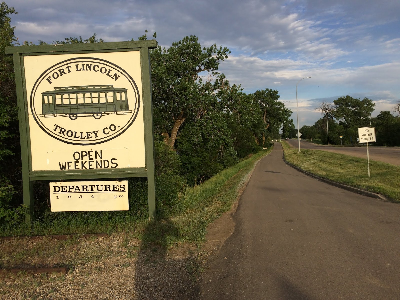
(...past the Fort Lincoln Trolley...)

(...and west again...)

(...where my impaired vision briefly returns...)

(...only to be restored before crossing Hwy 1806)...

(...past Stage Stop...)

(...on 3rd Street SE...)

(...to Mary Stark Elementary School...)

(...where I take a left onto 8th Avenue SW...)

(...until I reach the Mandan Municipal Golf Course...)

(...and veer right onto 7th Street SW...)

(...followed by a quick left on the trail east of 10th Avenue SW.)

(Heading south, the trail passes over...)

(...the Heart River...)

(...where I cross the road...)

(...and take a right to the entrance to the Northern Great Plains Research Laboratory.)

(Seeing the fork in the road...)

(...I take the road less traveled...)

(...past the soil processing building...)

(...until a quick left and through a narrow chute...)

(...leading me to a sidewalk...)

(...that passes two old buildings...)

(...until a roundabout...)

(...that opens to a parking lot...)

(...where I reach the west entrance of the main office building.  Commute done!)

The ride home is essentially the same route, excluding Burnt Boat Road in place of the paved trail to Chief Looking’s Village (much steeper, but more scenic).

Sunday, May 20, 2018

City Slickers 200k

The City Slickers 200k provides a wonderful opportunity to use a few (of the many) bike-ped trails in Minneapolis, St. Paul, and surrounding communities.  At 200k with minimal climbing, it’s an ideal early-season brevet.  It’s also a popular brevet (30+ riders this year), so there’s a good chance of riding with a local cyclist who knows the route.

This is a ride I’ve wanted to do since joining the Minnesota Randonneurs, and fortunately, a lapse in my work schedule provided an opportunity to participate this year.  I’m glad it worked out…   …the brevet will be remembered for helping a new randonneur complete his first 200k.

Below are a few photos.  Enjoy!  The City Slickers 200k is highly recommended!


(Randonneurs gather at the Lake Street Dunn Brothers)


(Rob Welsh, Minnesota Randonneurs RBA, provides an overview of the day)


(Riding with velomobiles...  ...a first!)


(Crossing the Minnesota River en route to Ft. Snelling State Park)


(Barges along the Mississippi River)


(Crossing the Mississippi River)


(Quickly in a rural setting on the way to Afton...  ...glad for the wide shoulder)


(Freshly tilled fields ready for planting)


(A small section of gravel...  ...I saw a cardinal on this stretch of road)


(Passing through Hudson, WI)


(Crossing the St. Croix River)


(Heading west after a brief stop in Stillwater)


(Passing by the 'World's Largest Snowman' in North St. Paul)


(Brief detour before crossing the Mississippi River)


(A much narrower river only a few miles upstream from the earlier crossing)


(Riding near Maple Grove...   ...more excellent trails)


(Storm approaching from the west)


(Rain and wind passed in time to enjoy the iconic Grain Belt Beer sign)


(Crossing the Mississippi River one last time, with downtown Minneapolis in the background)

Saturday, April 21, 2018

Run 4 Change

It’s been a slow start to the 2018 riding season.  Cooler than normal weather, coupled with consistent snowfall every 7-10 days since mid-March has made riding either too cold to bear or downright unsafe.  I didn’t start riding until last week.  Ugh…   …slow starts don’t bode well for early May brevets.  Anyhow…

The past four years I’ve had the pleasure of serving as the ‘pacer’ for Run 4 Change, a 1, 5, and 10 km noncompetitive run/walk to raise awareness of society’s attitudes about drinking and driving.  Tom and Arlene Deutcher, who lost four family members to a drunk driver in 2012, have courageously forged ahead to not only organize an event that has raised thousands of dollars to support programs that prevent drunk driving, but have worked with local politicians to impose stricter penalties and oversight on those who drink and drive in North Dakota.  Accordingly, context for the event provides an opportunity for reflection about one’s own family and friends, and the choices we all make to keep ourselves and others safe on the roads.

As the 10 km pacer, I've been following the same route along shared-use paths near the Missouri River in Bismarck.  The route begins in Sertoma Park and heads north just past the I-94 overpass before returning to Sertoma Park via an extended loop past the Dakota Zoo, softball diamonds, and amusement park.  It’s a mostly flat route with pleasant scenery and limited traffic.

My role is to stay ahead of the lead runner by 15-20 yards and inform other path users about the runner and (more broadly) the event.  The interactions are often an exercise in path-use diplomacy…   ..a smile and ‘Good morning’ often helps.  Most folks are amenable to adjusting to the right side of the path when requested.

My task is easy for the first three miles, as there’s typically only a handful of other path users to contend with.  The more challenging part of my role begins when we overtake the 5 km runners/walkers, who start after the 10 km race.  During this part of the pacing, I’m thankful I have a good bell to alert participants of the forthcoming lead runner.

This year Jennifer Eggert emerged quickly from the pack of 25 runners and maintained her lead through the entire 10 km race.  She ran impressively, averaging a little over seven minutes a mile.  Well done!

Here’s a few photos from this year’s event…


(Tom shares the mission of Run 4 Change)


(10 km runners at the starting line)


(One eye on the path, one eye on the mirror)


(An ice-free Missouri River)


(Lead runner near the three mile mark)


(BNSF Bridge from afar)


(BNSF Bridge up close)


(5 km runners/walkers ahead...   ...no more opportunities for photos from this point forward)


(Finished!)

Monday, December 25, 2017

Putting a Wrap on 2017

This year saw a significant uptick in mileage, eclipsing 2200 miles total.  Most mileage was attributed to commuting, where I logged over 75 trips to work.  Long-ish rides on the Koga-Miyata were limited to the one 200km brevet in Montana and time on the Mickelson Trail, both occurring before June.

A good year, overall.  Certainly less randonneuring than I’d like, but until my work and eldercare responsibilities lessen a bit, one or two brevets per year may be all that’s reasonably possible.

Looking forward to cycling in 2018!  I envision riding in Minnesota, as the TCBC randonneuring group has an excellent slate of planned rides.  There’s also the possibility of resurrecting singletrack riding next year, pending an addition to the stable.